In a park in the City of Lowell, MA, sits an enigmatic arrangement of stones known as the Druid Hill Stone Circle. Some have asserted that it is of ancient, pre-Columbian origin. Others are of the opinion that it’s simply a modern, decorative feature. While excavations in the 1980s provided key insights into the true age of the circle, it seems some questions will always remain.
The mound viewed from the west
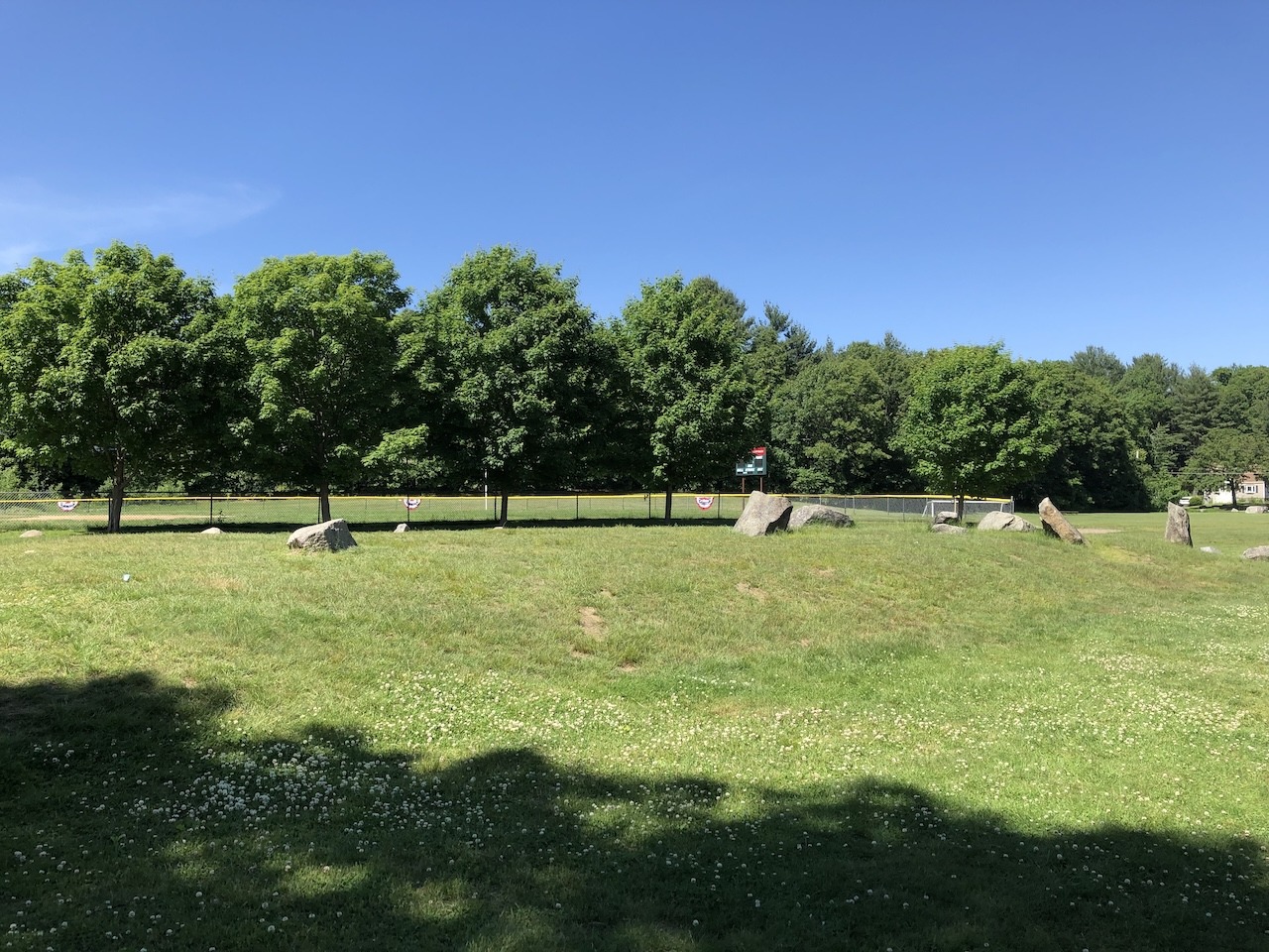
The Circle
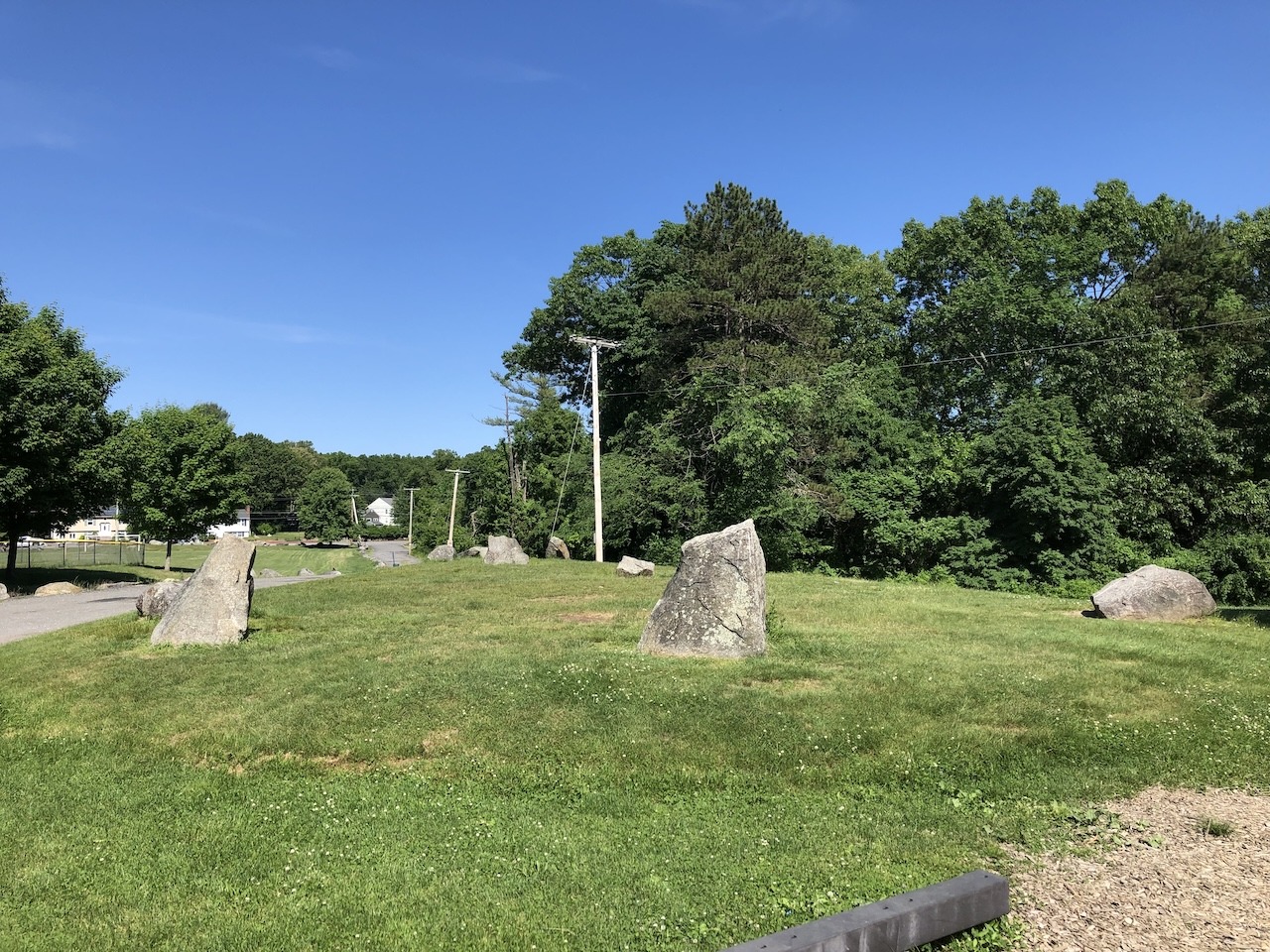
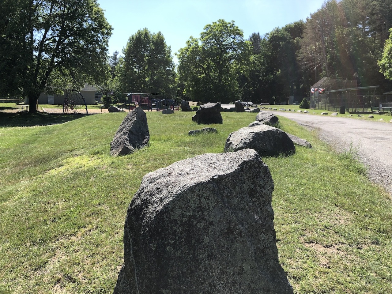
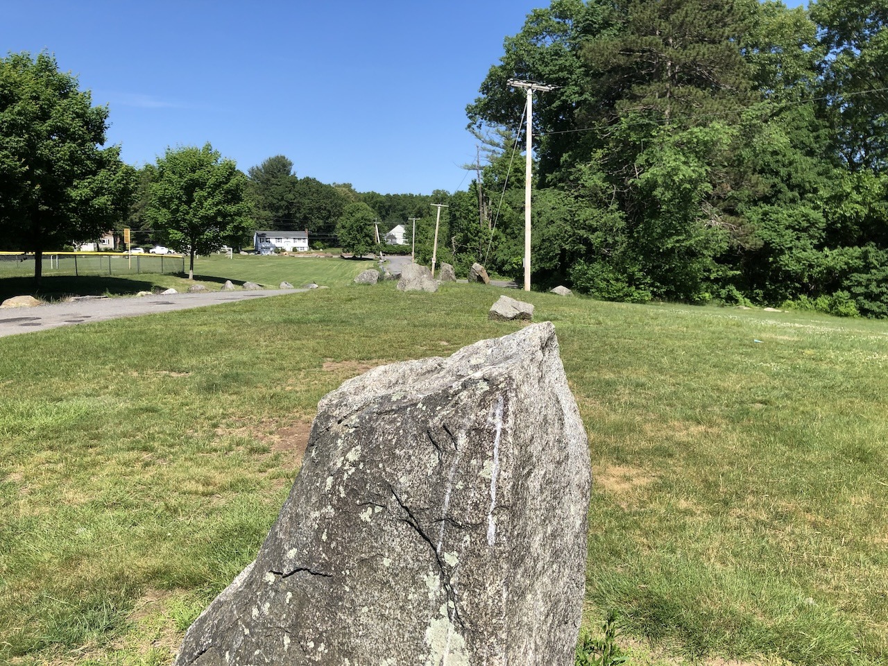
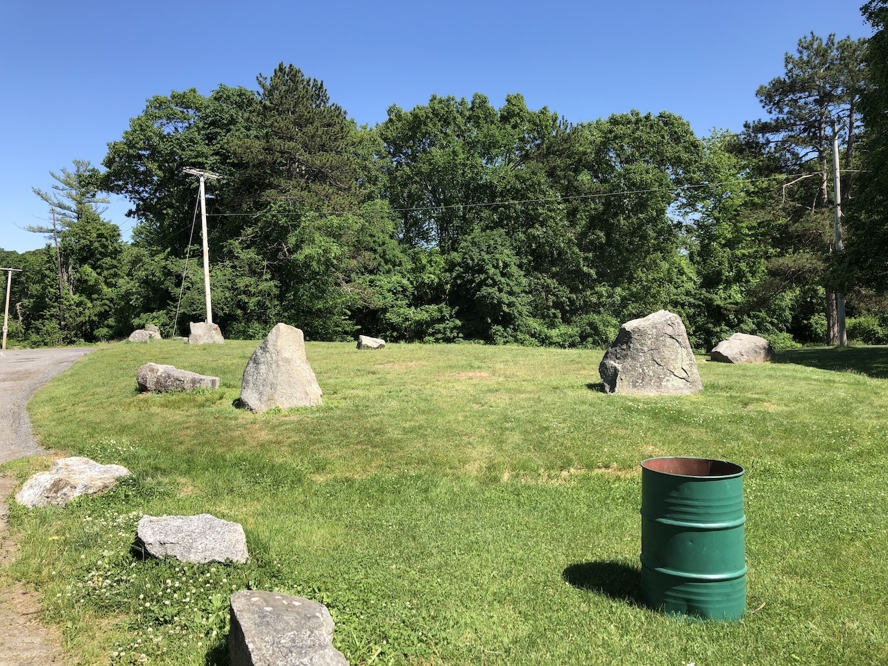
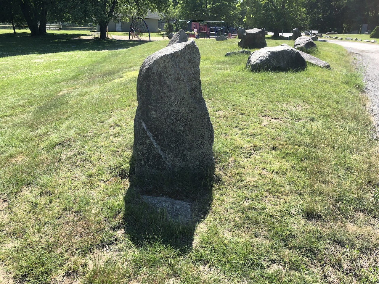
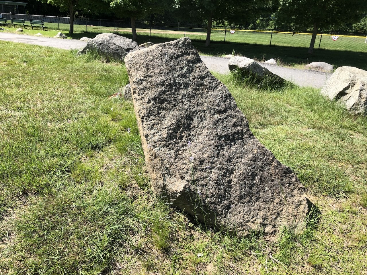
The stone circle can be found in LeBlanc Park, near the park’s playground and baseball field. It’s on the left side of the main driveway when heading towards the parking lot, so it’s very easy to spot. The stones sit on a mound that’s a few feet high. Although called a circle, it’s actually a teardrop shape that’s positioned roughly east to west. Groups of stones are arranged at both ends, as well as one stone in the middle. One might imagine that astronomical alignments could be observed, particularly when using stones at either end to create a line of sight to the sky. The sizes of the stones themselves are quite modest – about waist-high at best. As such, it’s small as compared to famous megalithic sites, but it has a certain charm all its own.
View of the stones looking from east to west
As is typical with New England’s enigmatic stone structures, there have been various theories as to who built the circle, when, and why. Some have believed that it was the product of pre-Columbian visitors from Europe. Others have wondered if it was the work of Native Americans. The more mundane theory is that the stone circle is a Victorian folly, built as an amusement of some sort.
View from middle west stone looking east
The Area
The Druid Hill Stone Circle is positioned on top of Druid Hill. The hill was formerly known as Bridget’s Hill, but it’s unclear when that term fell into disuse. An 1896 atlas map labels the area as Druid Hill, so the name must have been well established by that point. This same map also identifies a Druid Hill Spring nearby.
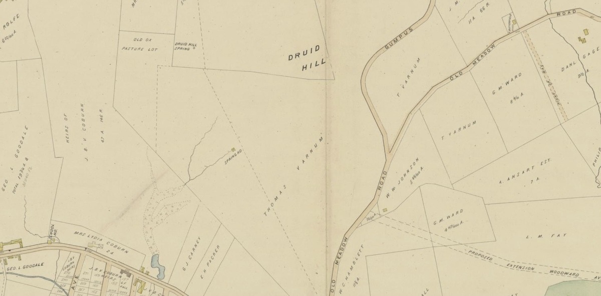
Section of map from 1896 (Source: Library of Congress)
The land was inhabited by the Pawtucket tribe when English colonists first arrived. The hill and surrounding area were acquired by the Varnum family in the 1660s. It remained in their possession until 1913, when it was claimed by the city in order to build an isolation hospital. In 1953, the hospital was demolished. The parcel is now home to a public park and two schools.
Interestingly, the hill has been part of three different New England municipalities. During the colonial period, it was part of Chelmsford. Then, a section of that town broke away to form Dracut in 1701. Finally, that part of Dracut was annexed by Lowell in 1874.
Mound viewed from the south
The Age
Determining the age of the stone circle based on the historical record is difficult. From what I’ve read, there are no early references to the stones in maps or documents. I, myself, have looked at a number of old maps of the area, and none have had any indication that there’s a special feature there. Even in the 1922 book History of Dracut, Massachusetts, there’s nothing about the stone circle – just a quick reference acknowledging the existence of Druid Hill and its previous name of Bridget’s Hill. Thus, the documents readily available provide no evidence that the Druid Hill Stone Circle was there in the distant past.
West side of mound, note the bin for perspective
Thankfully, an archeological investigation was conducted in 1985 by the Environmental Archeology Group and led by F.J.E. Gorman and John Pendergast. Digging at the stone circle yielded objects dating to the 19th and 20th centuries, such as trash, glass, clay pipes, etc. The mound itself appeared to be made of fill. Excavation on the standing stones revealed that they were set on top of paving stones that dated to around the turn of the 20th century. Paving stones were also found under the perimeter of the mound. (For more information on the dig and overall site, you can visit Daniel V. Boudillion’s Field Journal.)
Thus, the evidence gathered by the 1985 excavation strongly suggests the Druid Hill Stone Circle is a modern construction dating to around 1900.
And Yet
While the archeology seems to have closed the door on an ancient origin for the stone circle, perhaps there’s still a little mystery left. Some questions remain about the Druid Hill Stone Circle that haven’t been answered:
- If the stone circle was built around 1900, then the Druid Hill name likely predates it. One then wonders why the hill was named this in the first place. It would have seemed more likely that the hill was named for the circle, rather than the other way round.
- Why would the landowner, Thomas Varnum, have built this? Around the turn of the 20th century, his life was in a state of some flux. His wife of many years had died in 1891, and he then remarried in 1896. Varnum and his new wife had three children – born in 1898, 1900, and 1901. Could the stone circle have been built as a kind of commemoration?
- An origin date of around 1900 also makes one wonder how the mystery developed at all. That would mean that, within 85 years, this detail had been forgotten by the general populace. Of course, it was on property owned by a private citizen and then a hospital, so perhaps it was not widely known.
- Some people believe that the stone circle was originally located elsewhere on Druid Hill, on a spot where the hospital was set to be built. The stones were then moved to their current location in order to preserve them. That would explain why the modern paving stones were found at the site. Unfortunately, I’m not aware of any historical documentation to support this, but it’s an intriguing idea.
Another angle of eastern side of the mound
Lastly
Whether it is a modern folly or an ancient site, I found the Druid Hill Stone Circle to be intriguing and unique. It’s fun to live in a world where purposefully arranged standing stones sit peacefully in a park, and no one knows why they were put there. Perhaps, at some future date, more details about the construction of the circle will be discovered.
One of the stones
Location
LeBlanc Park
475 West Meadow Rd
Lowell, MA 01854
View Sources
Boudillion, Daniel V., “Druid Hill Stone Circle.” Field Journal. March 9, 2005. http://www.boudillion.com/druidhill/druidhill.htm.
“Civicons from Lowell Votes.” Lowell Votes. https://www.lowellvotes.org/wp-content/uploads/2019/06/LOV_Civicons_1.0.pdf.
Coburn, Silas Roger. History of Dracut, Massachusetts. Lowell, MA: Press of the Courier-Citizen Company, 1922. https://www.google.com/books/edition/History_of_Dracut_Massachusetts/FD7uObQEZF0C.
Corliss, William R. “Standing-Stone Cluster in Eastern Massachusetts.” Science Frontiers Online, no 40 (Jul-Aug 1985). https://www.science-frontiers.com/sf040/sf040p01.htm.
Fitzsimons, Gregory Gray. “Hawk Valley Farm.” Lowell Parks & Conservation Trust. April 1, 2014. https://lowelllandtrust.org/wp-content/uploads/2016/11/Hawk-Valley-Farm-Final-Report-Fitzsimons.pdf.
Howe, Richard. “Annexations to Lowell in the 19th century.” RichardHowe.com. October 23, 2021. https://richardhowe.com/2021/10/23/annexations-to-lowell-in-the-19th-century/.
Richards Map Company., Cartographer. Atlas of the city of Lowell Massachusetts. Springfield, Mass., L. J. Richards & Co, 1896. Map. https://www.loc.gov/item/map38000096/.
Written by A. P. Sylvia
