During the hysteria of the Salem Witch Trials, 19 people were wrongfully convicted and hanged by order of the court. Given the lasting impact that the trials have had on the city, one would assume that the execution site would have remained well known. However, this was not the case. In the prevailing centuries, the location was generally forgotten by the public on multiple occasions. Thanks to scholarly research, the lost site was rediscovered and confidently confirmed in 2016. A year later, a memorial was dedicated there, ensuring that the area will not fade back into obscurity.
Throughout much of recent history, if you were to ask someone where the Salem Witch Trial executions occurred, you would be directed to the top of Gallows Hill – which is a large hill located west of downtown. While the name alone implies it’s the execution site, there was also a 19th century argument for it. In his 1867 work, Salem Witchcraft, historian Charles Wentworth Upham stated his opinion that the executions occurred at the top of Gallows Hill, which he often referred to as Witch Hill. The book even included a map marking the location with a “W.” He based his assertion on a couple of points. One being that the hill is the highest point in the vicinity and thus would have been an appropriate and auspicious spot for a variety of reasons. Secondly, there was an old letter describing an account of a nurse watching the hangings from a house window. Upham attempted to deduce which house it was and knew the hill would be visible from there.
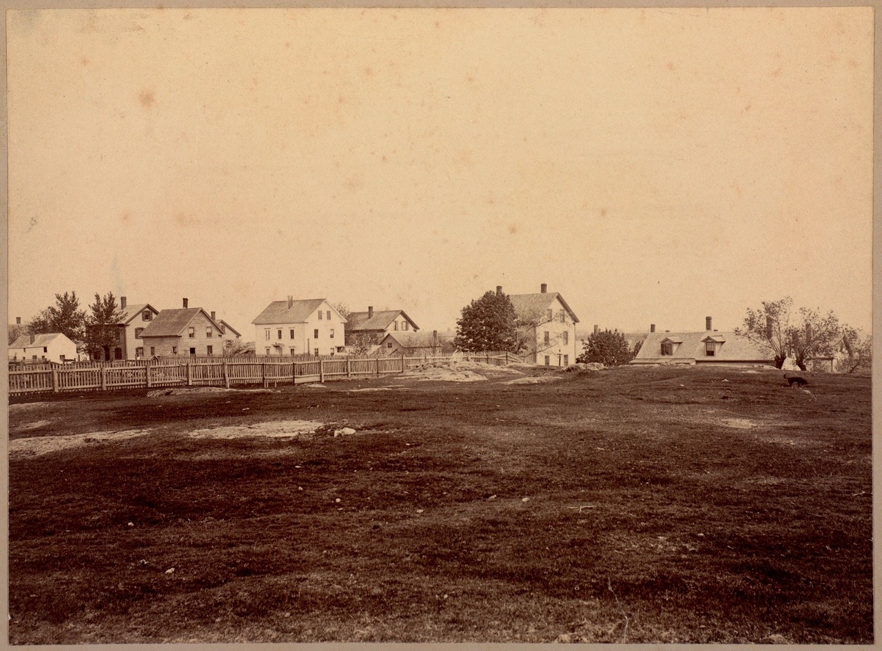
Photo titled: “Gallows Hill, Salem, where the witches were hung.” – c. 1895-1905
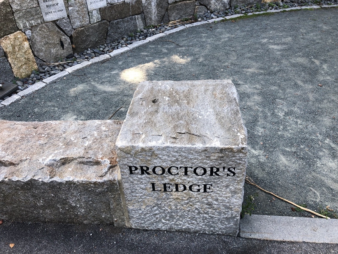
In the early 20th century, the Gallows Hill location was called into question. In the 1911 book A Short History of the Salem Village Witchcraft Trials, author M.V.B. Perley identifies an area on Proctor Street as the place of execution, referred to as “The Witch Plat.” He also marks a particular spot within that area as “The Crevice” – where the bodies of the hanged victims were thrown. This Proctor Street site is a raised area near the base of Gallows Hill, known as Proctor’s Ledge. It’s an entirely different location than the one Upham identified. Unfortunately, Perley makes no mention of how he came by this information.
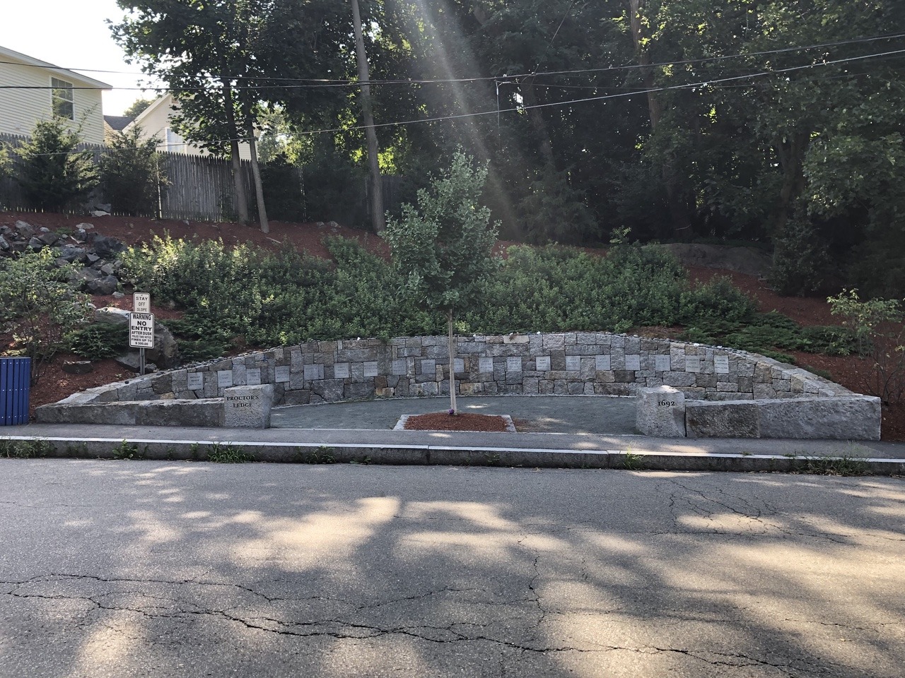
Memorial dedicated in 2017
The next blow to the Gallows Hill theory came in 1921 with an article by historian Sidney Perley entitled “Where the Salem ‘Witches’ Were Hanged.” In it, S. Perley offers a rebuttal to Upham’s work and contends that the execution site was Proctor’s Ledge (the same place identified by M.V.B. Perley ten years earlier). The article contains some convincing arguments:
- S. Perley noted that the condemned were brought on carts to the execution site. The steepness of Gallows Hill would make this a major undertaking, but Proctor’s Ledge would be much more reasonable to reach.
- The top of Gallows Hill was barren ledge, so a gallows would need to be built there. No paperwork could be found in town or county records indicating payments for lumber or workers. This suggests a different spot was used where ropes could be attached to tall trees.
- Perley researched eyewitness stories that were handed down and concluded that those people wouldn’t have had a clear view of the hilltop, but the ledge would have been visible. He also points out that Upham was incorrect in his identification of the house where the eyewitness viewed the hangings, as it was constructed in 1730.
- When future president John Adams visited the execution site in 1766 (which he referred to as “Witchcraft hill”), he noted there were many locust trees. While there were no trees on the barren top of Gallows Hill, there had been locust trees at Proctor’s Ledge.
- There was no crevice at the top of the hill that bodies could be thrown into, while there was a suitable crevice by the ledge.
- Tradition held that, after the executions, a strange tree with a hole in the trunk was found at the site. It was known as the “witch tree” and babies would be passed through the hole to protect them from witchcraft. While the tree was no longer standing, its location had been Proctor’s Ledge.
- It was known that some of the bodies of the victims were transported away from the execution site on the river. This wouldn’t be feasible at the top of the hill, but the river would have been expedient for reaching the ledge.
- Tradition never held that the top of Gallows Hill was the execution site. Rather, there were numerous traditions that it was the area that became known as Proctor’s Ledge.
Sidney Perley’s article must have indeed been convincing, as the City of Salem bought the land containing Proctor’s Ledge in 1936. The City called it “Witch Memorial Land” and intended for it to be a public park. However, no markers were placed there at the time.
I’ll also mention that some maps featured this important change. Six years before the article came out, Sidney Perley’s son produced a tourist map identifying Proctor’s Ledge as the site. Another map, produced by William W. K. Freeman in 1933, was based on Perley’s work and marked Proctor’s Ledge as the “Probable Place of Executions.”
Given the maps, Perley’s strong case, and the land purchase, you would think public perception might have shifted. However, the shadow of Gallows Hill fell back over Proctor’s Ledge as the century bore on. Even in 1930, nine years after the article, a tourist map by Helen Washburn marked the top of Gallows Hill as the execution site.
In 2016, a group of seven scholars, known as the Gallows Hill Project, settled things once and for all. They corroborated the work of Sidney Perley and confirmed that the execution site was indeed Proctor’s Ledge. The team took a multidisciplinary approach to their research, which took five years to complete. One major piece of evidence was witch trial testimony in which an accused, Rebecca Eames, stated that she saw the hangings that morning. Based on her statement, the team was able to determine the spot where she viewed the execution. They utilized a geographic information system to make a virtual model of 17th century Salem based on historic maps, aerial photography, and modern topography. The system showed that Proctor’s Ledge would have been visible, while the hilltop would have been hidden. Ground penetrating radar was also used on the ledge, which confirmed oral tradition that there were no burials.
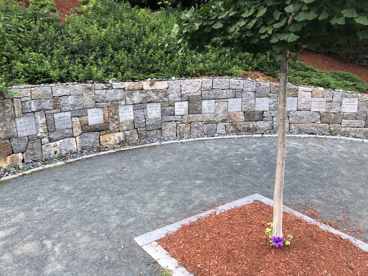
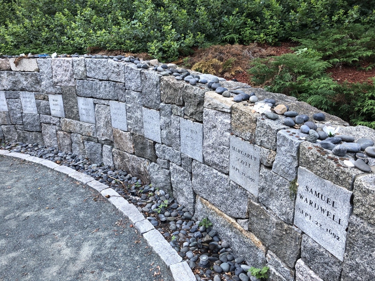
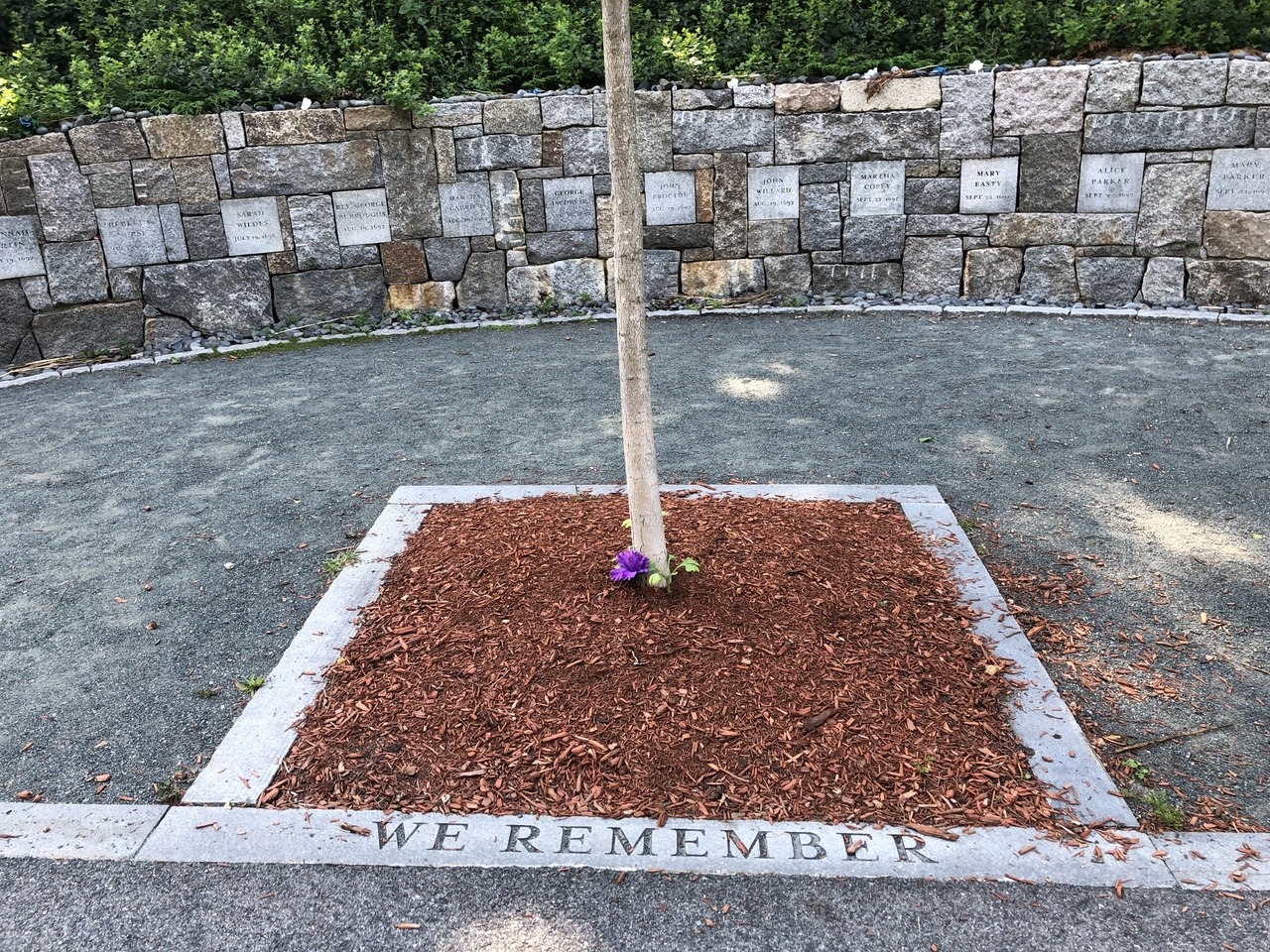
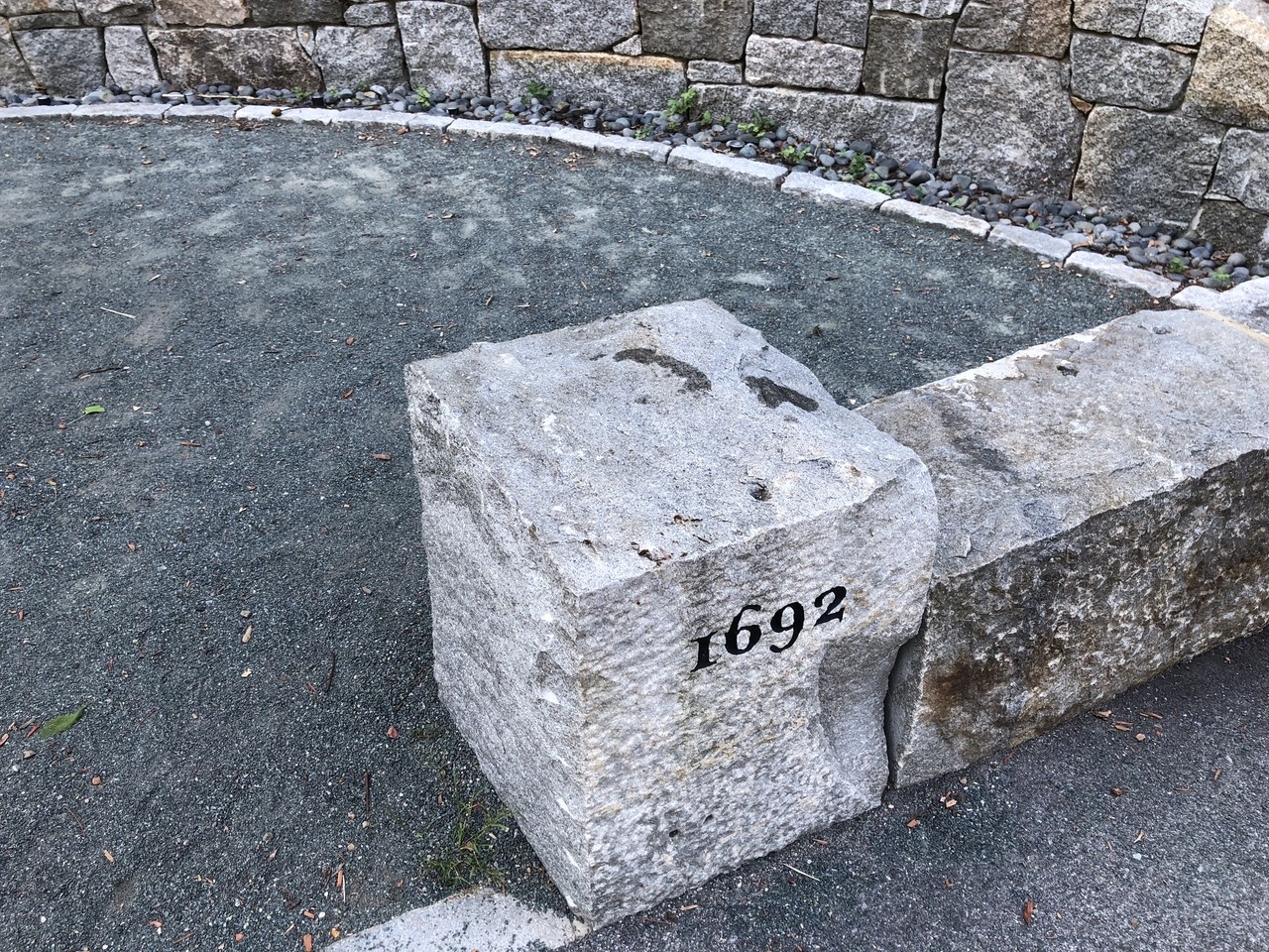
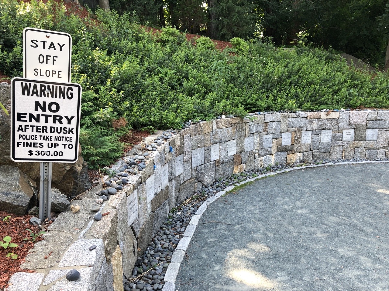
After the findings were released, the City of Salem commissioned Martha Lyon Landscape Architecture to design a memorial to the victims that would be placed at Proctor’s Ledge. Dedicated in 2017, the memorial consists of a semicircular granite retaining wall around a white oak sapling. The names of the 19 people executed, along with their dates of execution, were carved into stone blocks and set into the wall. (Giles Corey’s name is not present, as he was not technically executed – rather, he was killed elsewhere while being tortured in an attempt to force him to make a plea.) At the base of the wall are small, smooth stones and lights that illuminate the names at night. The oak tree is meant to symbolize the tree that was used as the makeshift gallows. Overall, it is an understated and solemn monument.
The memorial is located in a residential neighborhood, over a mile from the main tourist area of Salem. It abuts the sidewalk on Pope Street, about halfway down on the west side. The monument is built into the side of Proctor’s Ledge. There is no parking at the site, so I’ve heard it recommended that visitors should park at the lot for Gallows Hill Park and walk down.
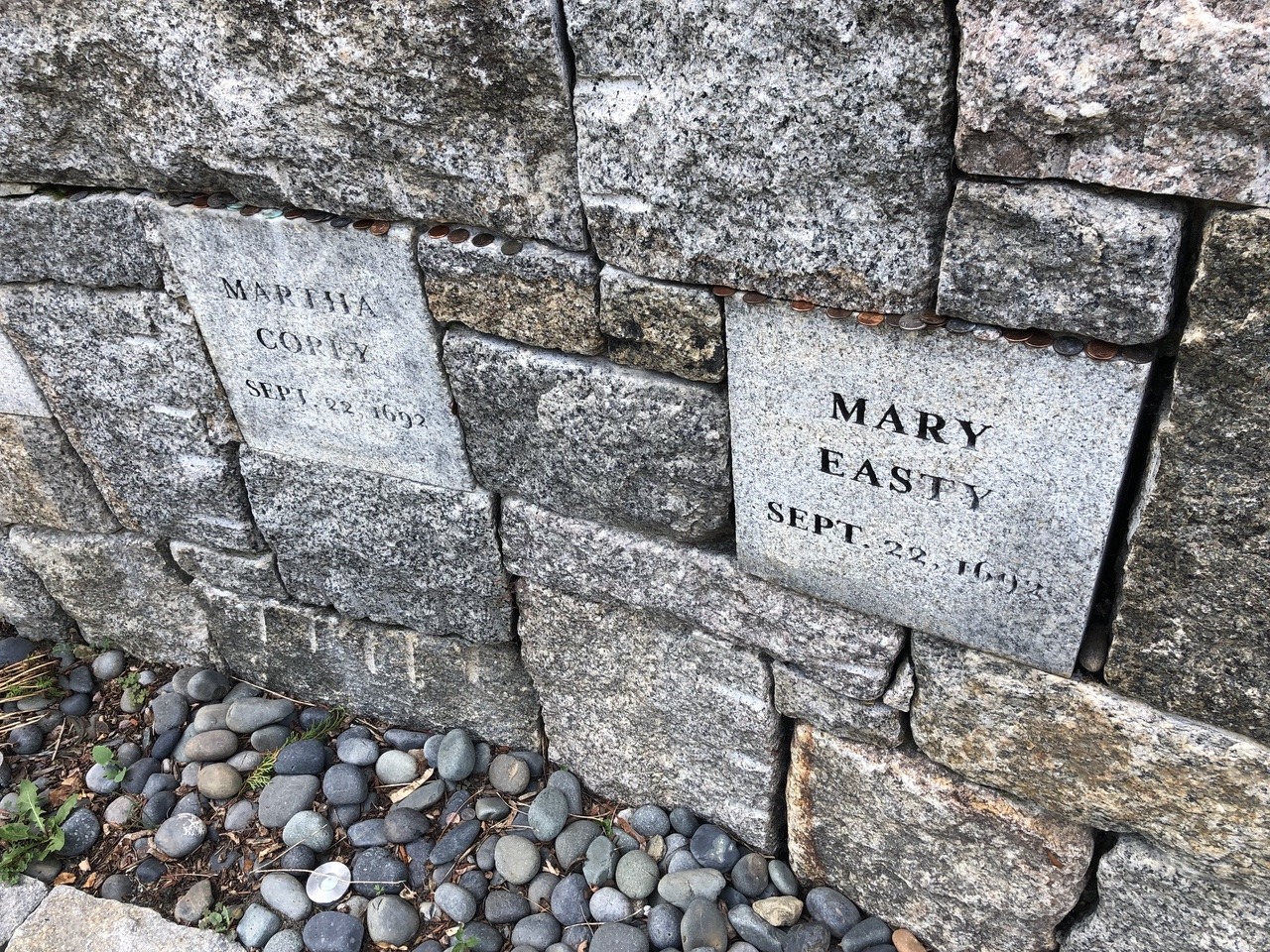
Note the coins in between the stones
Away from the hustle and bustle of the downtown, the Proctor’s Ledge Memorial offers a place for quiet contemplation. It’s a tangible reminder that 19 innocent people were executed there due to an unjust court fueled by baseless accusations and hysteria. I’m thankful that modern scholarship has been able to definitively prove that Proctor’s Ledge was indeed the execution site, and the city’s memorial will help ensure that the site won’t fade from memory again.
Location
Proctor’s Ledge Memorial
Pope St
Salem, MA 01970
View Sources
“Actual Site of Salem Witch Hangings Discovered.” CBS Boston, January 13, 2016. https://www.cbsnews.com/boston/news/actual-site-of-salem-witch-hangings-discovered/.
Armstrong, Toni. “Andover Bewitched: Commemorating the Trials.” History Buzz, July 13, 2022. https://historybuzz.substack.com/p/andover-bewitched-commemorating-the.
Baker, Emerson W. “A Memorial for Gallows Hill.” OUPblog, January 13, 2016, https://blog.oup.com/2016/01/memorial-gallows-hill/.
Brooks, Rebecca Beatrice. “Proctor’s Ledge Memorial.” History of Massachusetts Blog, May 5, 2019. https://historyofmassachusetts.org/proctors-ledge-memorial/.
“Gallows Hill, Salem, where the witches were hung.” Photograph. [ca. 1895–1905]. Digital Commonwealth, https://ark.digitalcommonwealth.org/ark:/50959/tq57p176r (accessed November 13, 2023).
Kahn, Sonia. “Double Double Trials and Trouble.” Library of Congress Blogs, October 31, 2022. https://blogs.loc.gov/maps/2022/10/double-double-trials-and-trouble/.
MacNeill, Arianna. “Proctor’s Ledge in Salem Confirmed as Witch Execution Site.” The Salem News, January 11, 2016. https://www.salemnews.com/news/local_news/proctors-ledge-in-salem-confirmed-as-witch-execution-site/article_d9e2a242-fdf7-56ac-94eb-5e3f943d0cc3.html.
Newman, Caroline. “With UVA’s Help, Salem Finally Discovers Where Its ‘Witches’ Were Executed.” UVA Today, January 19, 2016. https://news.virginia.edu/content/uvas-help-salem-finally-discovers-where-its-witches-were-executed.
“Part of Salem in 1700.” Salem Public Library, Salem, Mass. https://digitalheritage.noblenet.org/s/salem/item/11432.
Patel, Samir S. “Salem’s Lost Gallows.” Archeology, January/February 2017. https://www.archaeology.org/issues/241-features/top10/5120-salem-witch-trials-gallows.
Perley, M. V. B. A Short History of the Salem Village Witchcraft Trials. Boston: The Tudor Press, 1911; Project Gutenberg, January 22, 2017. https://www.gutenberg.org/ebooks/54042.
“Proctor’s Ledge Memorial: Site of the 1692 Salem Witch Trial Executions.” Martha Lyon Landscape Architecture, LLC. https://www.marthalyon.com/portfolio/remember/Proctor’s+Ledge+Memorial:+Site+of+the+1692+Salem+Witch+Trial+executions.
Seger, Donna A. “Eight Firebrands.” Streets of Salem, September 22, 2014. https://streetsofsalem.com/2014/09/22/eight-firebrands/.
Upham, Charles W. Salem Witchcraft. 2 vols. New York: Frederick Ungar, 1969; Project Gutenberg, February 24, 2006. https://www.gutenberg.org/ebooks/17845.
Woodside, Christine. “The Site of the Salem Witch Trial Hangings Finally Has a Memorial.” Smithsonian Magazine, July 13, 2017. https://www.smithsonianmag.com/history/site-salem-witch-trial-hangings-finally-has-memorial-180964049/.
Written by A. P. Sylvia
